PDF of the report.
Introduction

A significant portion of the Mountain Valley Pipeline route through Giles, Craig, & Montgomery county crosses karst terrain. In May, 2019, an underground cavity or small cave was opened due to blasting in the MVP Right of Way near the Craig / Giles county line. The exposed rock shown in Figures 3 and 4 is limestone of high calcium carbonate content, and effervesces violently with contact to 10% HCl. Air temperatures (that day) in the ROW were in the mid to upper 80s as shown in Table 1, yet temperature readings at two cave openings were measured in the low to mid 50s. It is clear that an underground cavity exists in this area.
Location
Figure 1 shows the location of the area in question, which falls between mile markers 216 – 216.5. This is in southeastern Giles county near the Craig county line. Blue dots in Figure 1 show the locations of photos taken in the field. Figure 2 examines terrain model flow paths from the ridge to the valley floor and Sinking creek. Area of exposed cavern is shown below in the red oval.

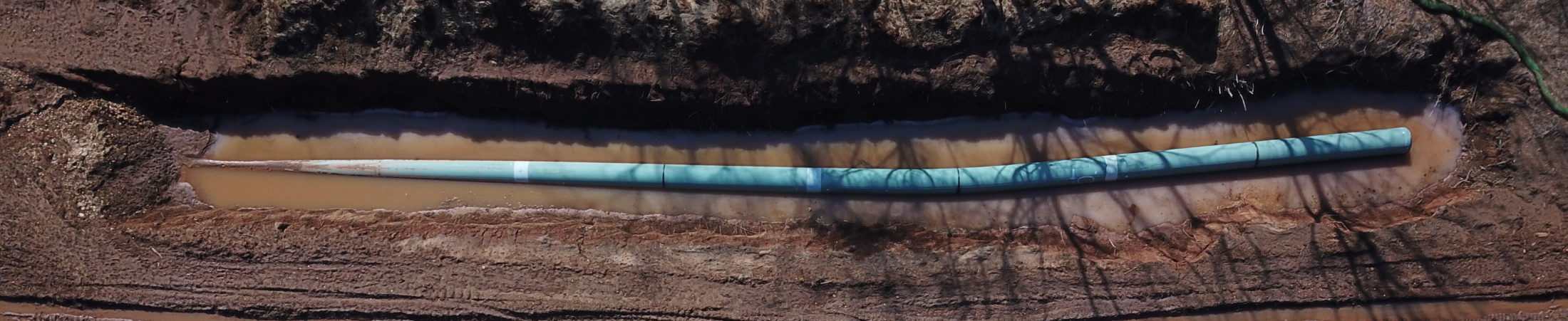
Field images show areas of subsidence along row, some of which were significant enough to encircle in silt fence. Blasting exposed cavities that were not visible before construction began. Examples are available in figures 3 and 4.
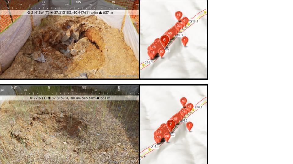

The recently exposed portions of rock reveal an HCL reaction as seen in the lower image of Figure 5. The upper image in figure 5 looks very similar to other cave surfaces observed in Giles county. Figure 6 shows a temperature reading at one of the openings.


Figure 7 shows more of the exposed karst features, that look very similar to other cave surfaces found in Giles. Figure 8 shows a temperature reading at a second opening.


A review of weather data from the Roanoke regional airport is shown in table 1. There was an approximate 5 degree variation in air temperatures at the site location compared to the measured values in table 1.
| Time | Temperature | Humidity | Wind | Wind Speed | Wind Gust | Condition |
| 7:54 AM | 86 F | 48 % | NW | 16 mph | 22 mph | Partly Cloudy |
| 8:54 AM | 88 F | 45 % | WNW | 15 mph | 24 mph | Fair |
| 9:54 AM | 89 F | 43 % | WNW | 21 mph | 25 mph | Partly Cloudy / Windy |
| 10:54 AM | 91 F | 39 % | WNW | 16 mph | 23 mph | Partly Cloudy |
| 11:54 AM | 90 F | 42 % | N | 10 mph | 0 mph | Mostly Cloudy |
| 12:54 PM | 90 F | 40 % | WNW | 15 mph | 0 mph | Mostly Cloudy |
| 1:54 PM | 89 F | 45 % | WNW | 14 mph | 0 mph | Mostly Cloudy |
Table 1: Temperature readings at the Roanoke regional airport on 5/24/2019.
Additional Site Images
Additional visits to the site show expanding areas of subsidence.


Conclusions
Blasting in the vicinity of karst systems can present significant threats to both residential water sources and to the structural integrity of a large, high-pressure pipeline. Blasting may affect localized depth to groundwater, recharge characteristics and water quality. The main problems associated with construction in karst terrain are:
- difficulties in excavation and grading the ground over pinnacled rockheads;
- collapse of the roof over subsurface voids, subsidence of cover soil over sinkhole, and
- difficulties in founding a structure over an irregular or pinnacled rockhead.
All of the above are occurring as shown by photos.
It is clear that an underground cavity exists in this area. Blasting for the pipeline trench exposed the underground cavities within the construction right-of-way.
The extent of the underground caverns, potential impacts to underground aquifers and potential structural impacts to the pipeline needs further evaluation.